Junbiao Tu1, Jiaxue Wu2, * , Daidu Fan1 , Zhiyu Liu3 , Qianjiang Zhang4 , and William Smyth5, *
1State Key Laboratory of Marine Geology, Tongji University, Shanghai, China
2School of Marine Sciences, Sun Yat-sen University, Zhuhai, China
3State Key Laboratory of Marine Environmental Science, and Department of Physical Oceanography, College of Ocean and Earth Sciences, Xiamen University, Xiamen, China
4State Key Laboratory of Satellite Ocean Environment Dynamics, Second Institute of Oceanography, Ministry of Natural Resources, Hangzhou, China
5College of Oceanic and Atmospheric Sciences, Oregon State University, Corvallis, OR, USA
*Corresponding author.
E-mail address: wujiaxue@mail.sysu.edu.cn (J. Wu); smyth@coas.oregonstate.edu; bill. smyth@oregonstate.edu (W. Smyth)
Abstract
Shear instability is a dominant mechanism for mixing in the stratified oceans and coastal seas. For the first time, we present fine-scale, direct measurements of shear instabilities in the bottom front generated by the Kuroshio intrusion into the Changjiang (Yangtze) river plume. Shear instabilities were identified using a shipboard echo‐sounder and the resulting turbulent mixing was quantified using a turbulence microstructure profiler. The shear instabilities generate vigorous turbulent mixing with dissipation rate and vertical diffusivity up to O (10− 4 m2 s− 3) and O (10− 1 m2 s− 1), respectively, comparable to values associated with shear instabilities observed in river plumes and western boundary currents but several orders of magnitude larger than typical values in the open ocean. The enhanced turbulence may contribute significantly to mixing between the Kuroshio water and coastal water and thereby alter the coastal biogeochemistry cycles
Full article:https://doi.org/10.1029/2024GL110957

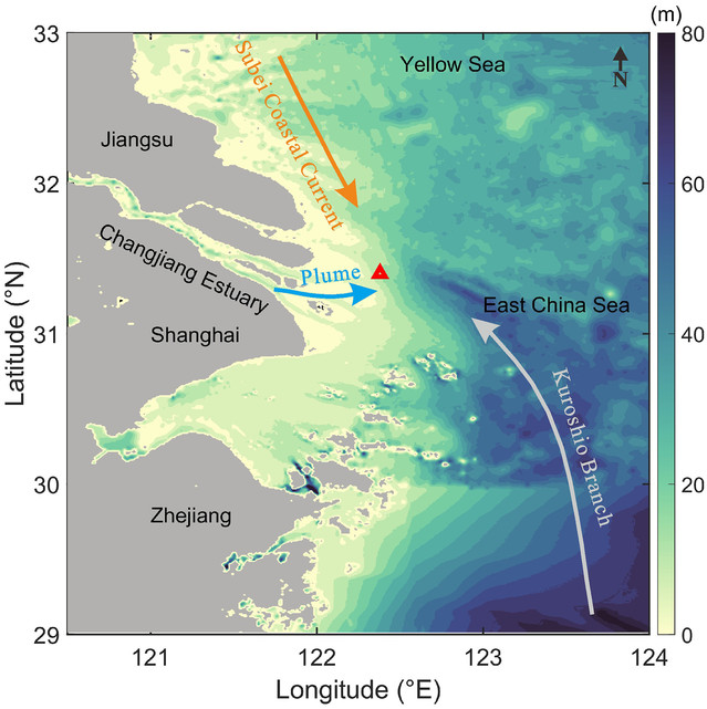
Fig. Bathymetry of the Changjiang River estuary and its adjacent sea. The mooring site is marked by a red triangle.

